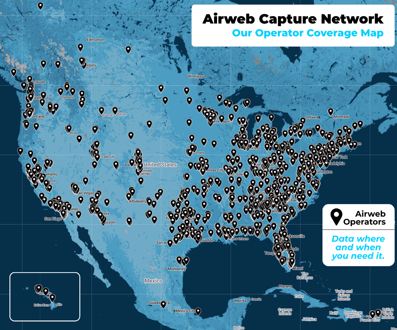
We replace manual parking studies with drone tech & AI to capture areas as small as parking lots up to 100+ acres at a time. Our drone pilot network covers every area across the U.S., Canada, & Puerto Rico - ready to fly within 72 hours of request.
Request Parking StudyOrder Raw Data Only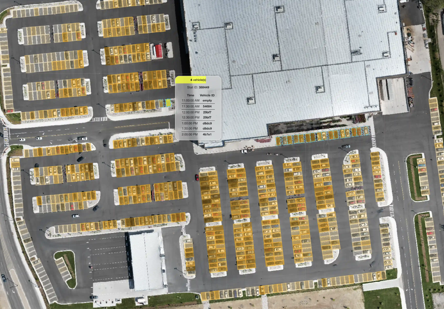
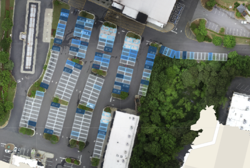
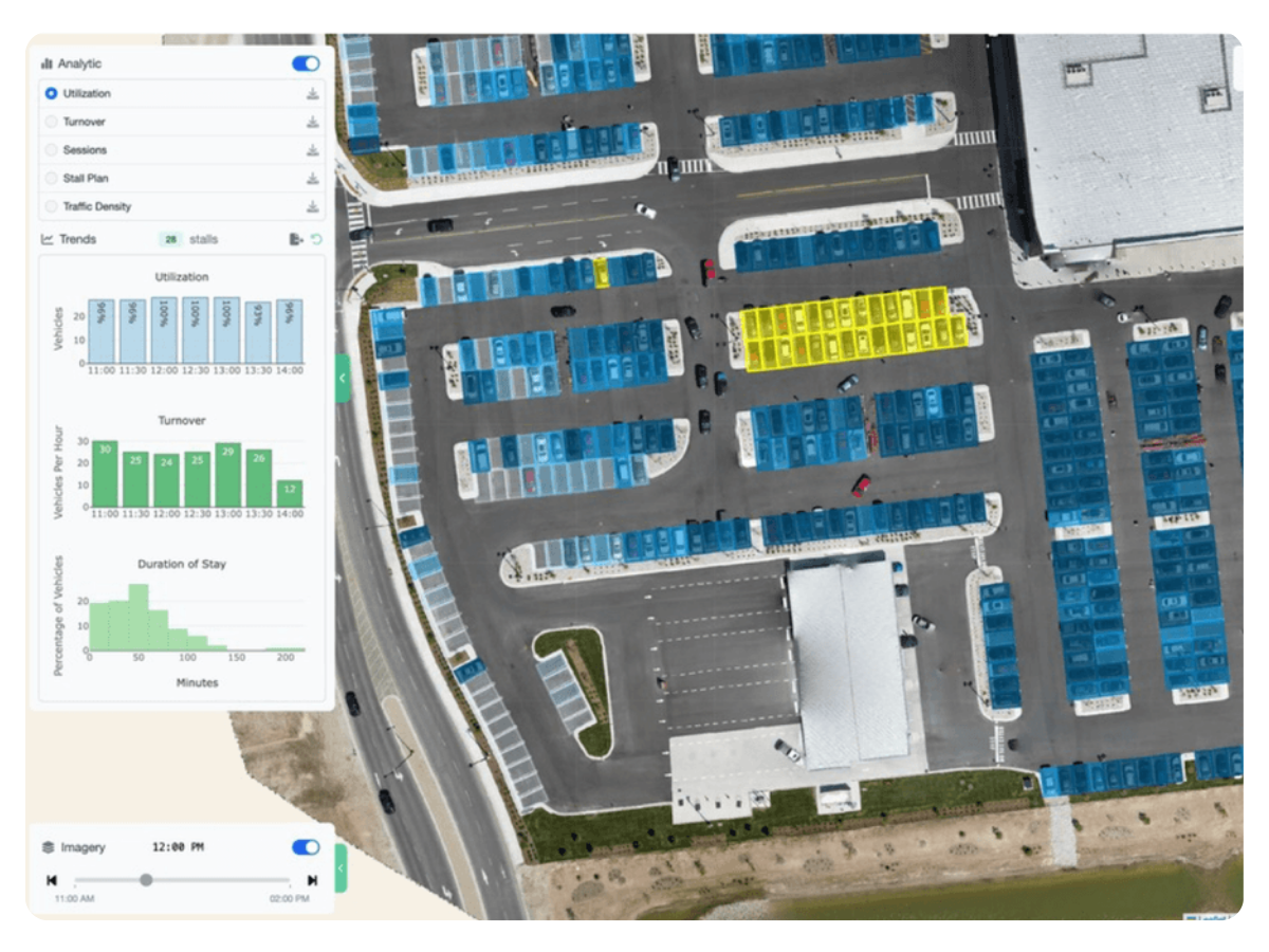
See exactly when and where stalls are occupied or vacant.
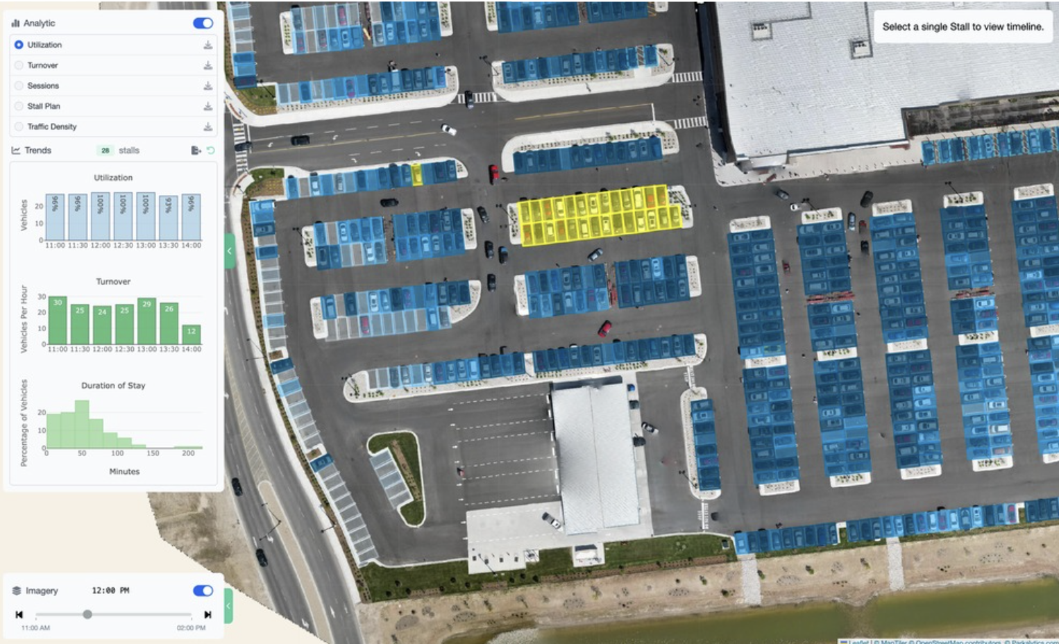
Measure how long vehicles stay—from short stops to all-day parkers.
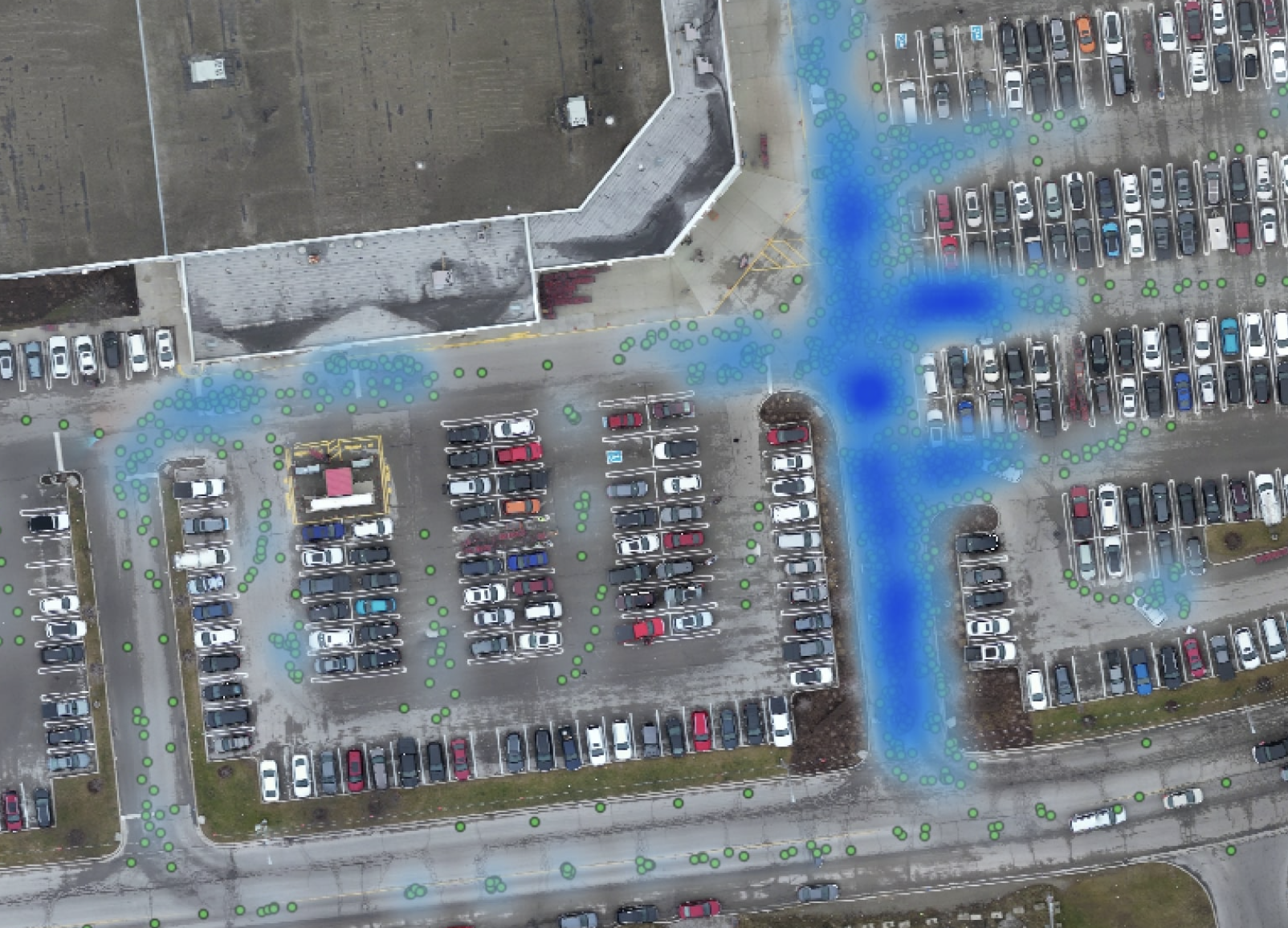
Track stall-by-stall turnover and circulation patterns for better design.
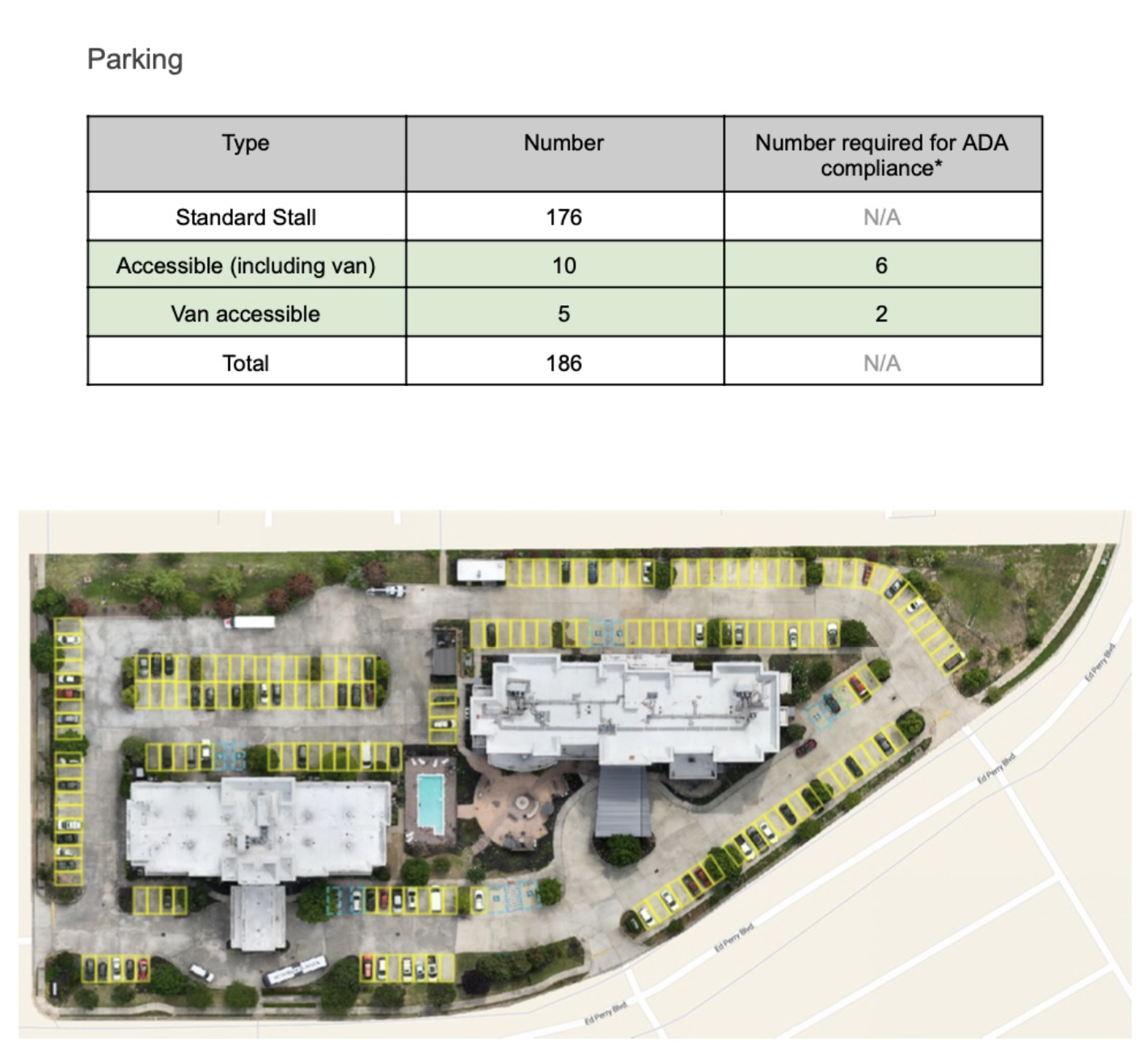
Quantify ADA stall demand vs supply to inform compliance and planning.

Connect parked vehicles to traffic and pedestrian flows for a full picture.
Export DXF, GeoJSON, and CSV for engineers, planners, and asset systems.
Manual counts miss context. Site visits burn hours. Decisions get delayed.
We fix that with drone-powered, AI-verified parking studies that scale from one lot to your entire portfolio.

Underused Assets → Empty stalls waste capital, while peak zones overflow.

Manual Counts Fail → Clipboard surveys and ground tallies are slow and error-prone.

Missed Compliance → Accessibility requirements are hard to track without data.


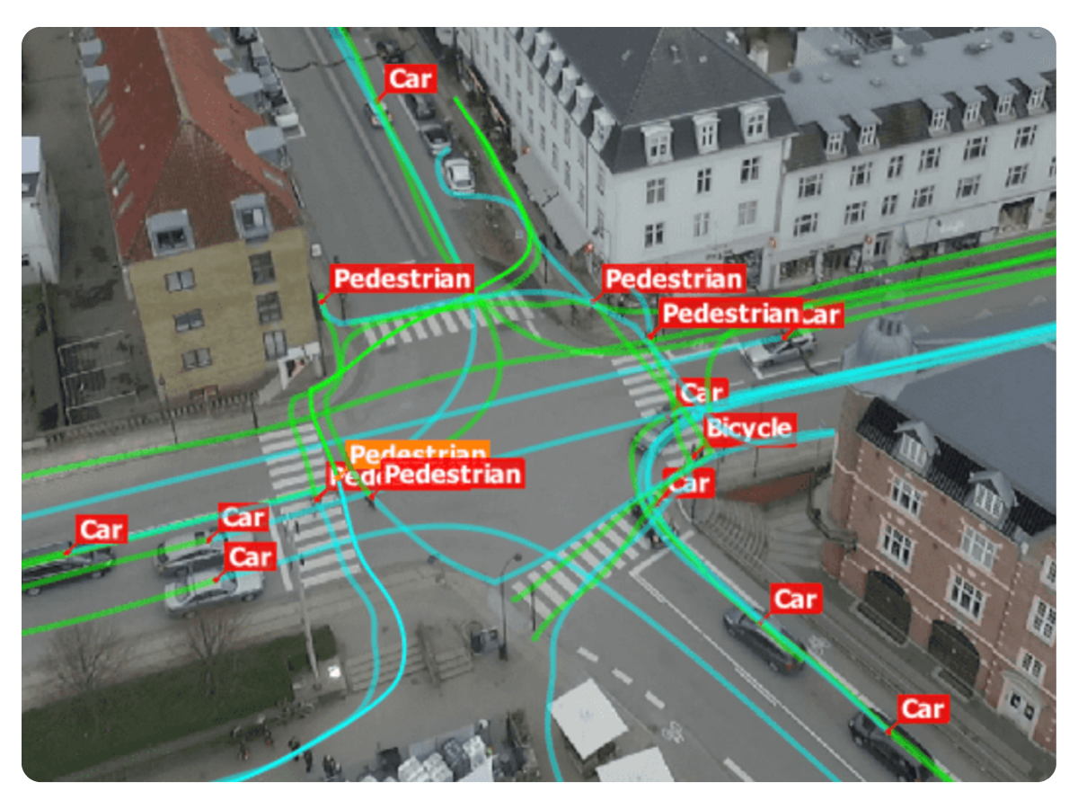
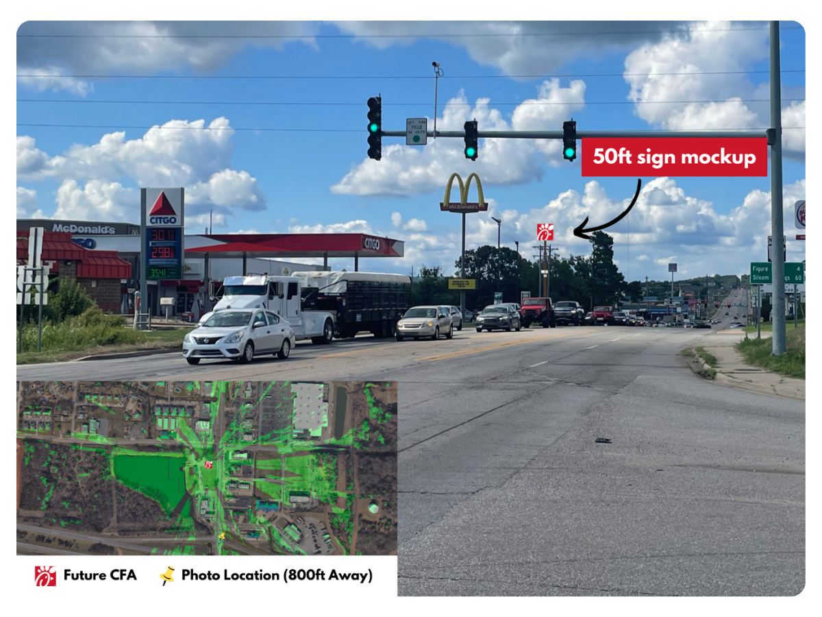
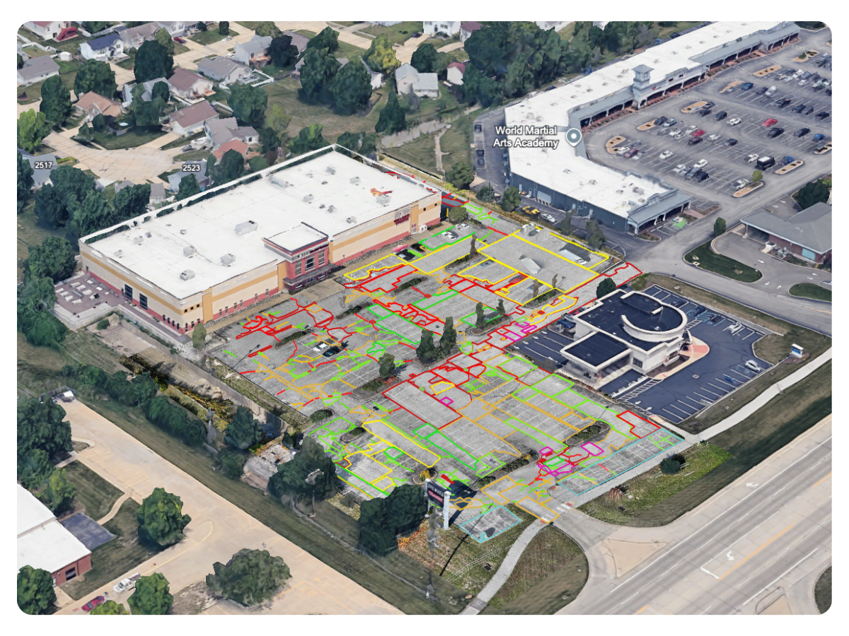
Understand traffic volume, turning movements, and behavior before investing capital.
See Example Project →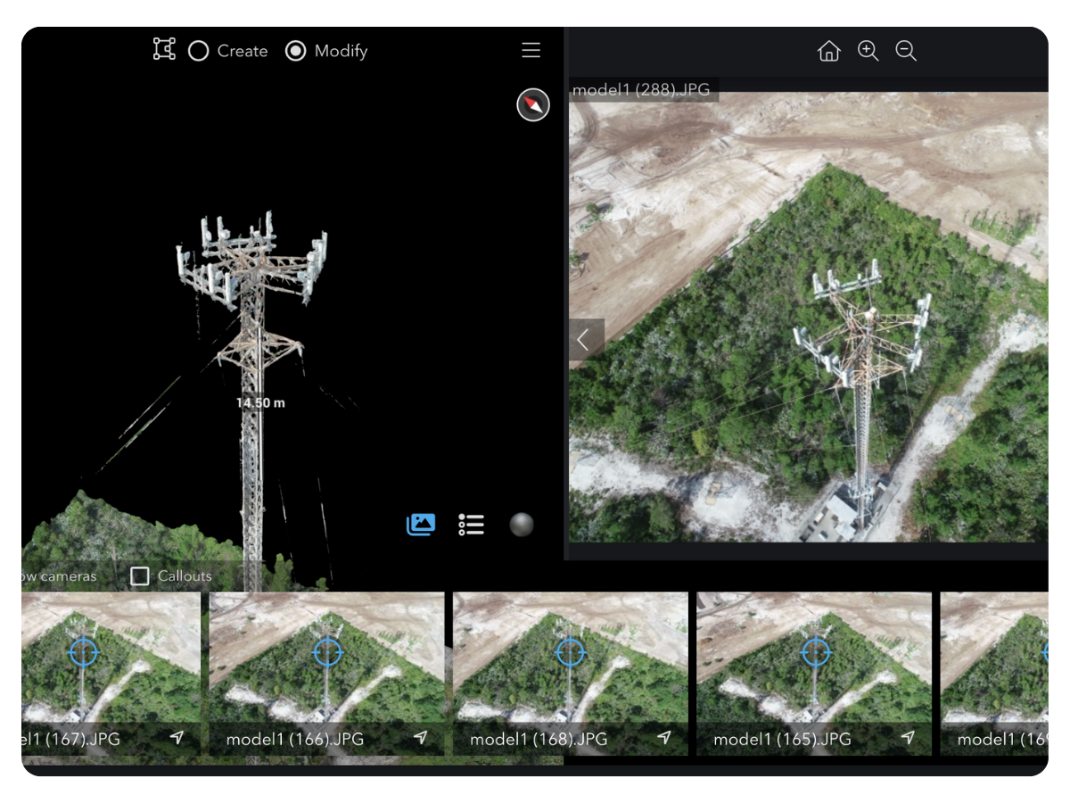
Prevent outages and failed installs with accurate, inspection-grade tower data.
Request Tower Data →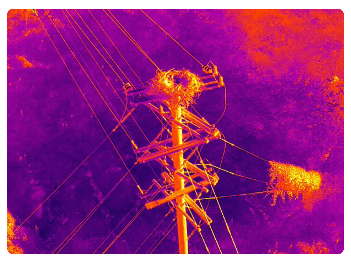
Find defects and clearance risks early to avoid outages and emergency repairs.
Request Pole Data →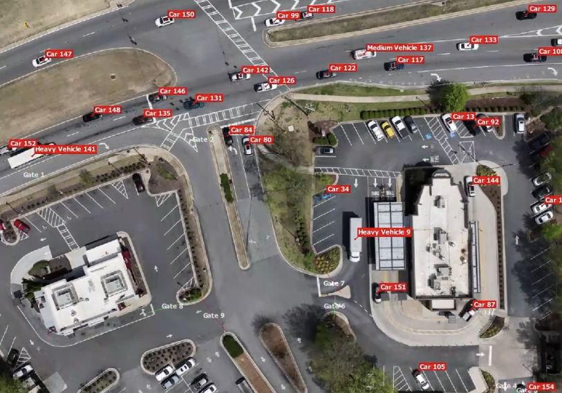


.png)