How Drone Data can be used by Engineers for Remote Inspections
In our experience, we've seen how drone data automates acquisitions of large infrastructure across nations.
Let's take the example of cell phone towers and how data acquired by drones is used by engineers to create 3D models to conduct remote site audits safer, faster, and more efficiently.
Let's take the example of cell phone towers and how data acquired by drones is used by engineers to create 3D models to conduct remote site audits safer, faster, and more efficiently.
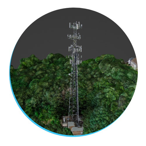
3D Model of a Self Support Tower
First, we will identify some goals that an engineering firm might set when looking at drones as a tool.
1) Accurate data for photogrammetry
When conducting a remote site audit of vertical infrastructure, it's important to determine high accuracy so that measurements can be identified confidently. This results in the use of GCP's (ground control points) and a consistent flight plan in the field.
GCP's must be placed in visible areas, vertically and horizontally level around the base of the tower, and display measurements in a bright and noticeable way. This allows for the georeferencing process to be quicker and more efficient with scalable projects, as well as, the measurements to be easily seen on sunny days.
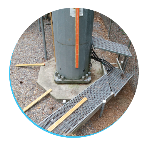
GCP's placed horizontally and vertically level on the base of the tower
2) Clean overlap and consistent flight plan
All flights must start with a Nadir (vertical downward) angle of the tower to capture the scene and reference for the 3D model. Flight patterns are broken into 2 main flight paths, depending on the type of tower you're inspecting:
All flights must start with a Nadir (vertical downward) angle of the tower to capture the scene and reference for the 3D model. Flight patterns are broken into 2 main flight paths, depending on the type of tower you're inspecting:
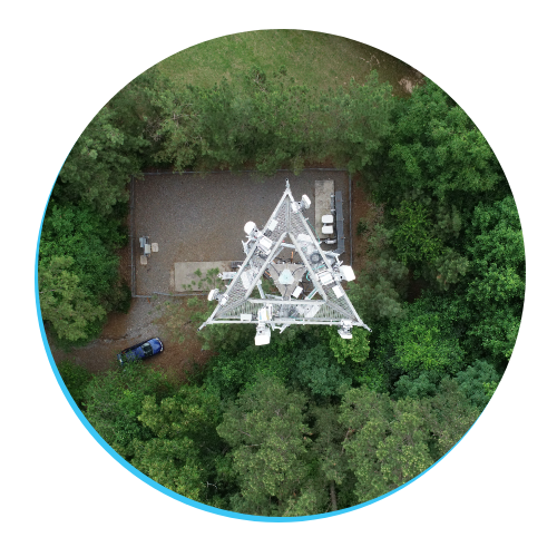
Example of a Nadir angle to begin capturing your data
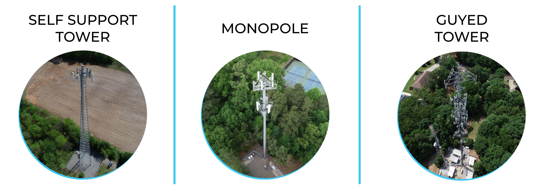
SST and Monopoles: This structure will require orbits at 25-30ft radius and consistent drops at 10ft-15ft altitude. At sections of equipment like arrays, you would want to ensure you capture the total height of the equipment in at least one rotation. This will help with the processing the 3D model by having enough tie-points of complex equipment and will minimize un-usable models.
Guyed Towers: Instead of an orbit flight path, you would begin a vertical descent from the top of the wire to the base of the tower. Next, you would sweep across (staying within the same section of wires) and begin a vertical flight to the top of the tower. When there is a set of arrays wrapped around the tower, you would sweep across back and forth, then continue your ascend.
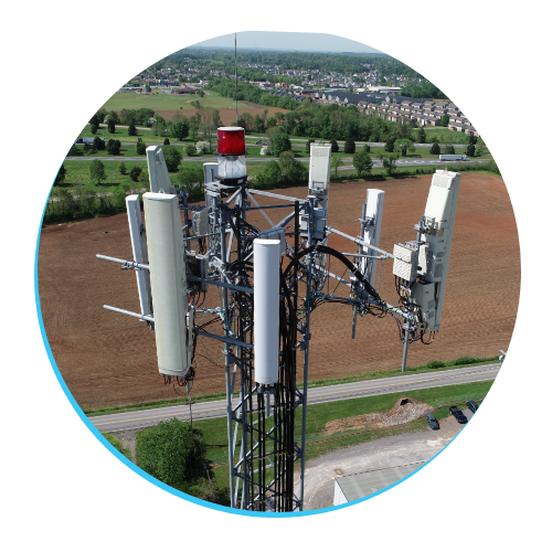
Example of arrays being visible from top to bottom
3) Organized process of data transfer
The transfer portion of this process is probably the most important part because if files aren't categorized correctly or lost upon upload then there is no model to be made. To minimize error, you could opt-in to a seamless transfer from drone storage to cloud, similar to platforms such as Skydio Cloud.
A cloud-based transfer solution can decrease probability for error compared to transferring data from micro SD card to hard drive, then to FTP servers.
Drones are used to gather data in hard-to-reach areas. We can get this data much faster than traditional methods, without risking human lives, while providing more value with an aerial perspective.
Start your project with Airweb Digital >>
Start your project with Airweb Digital >>