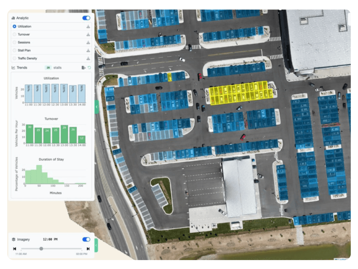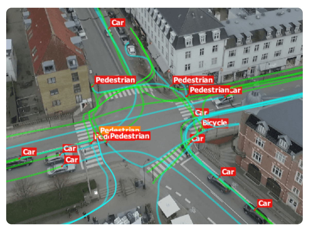
Capture real traffic patterns and turning data without installing hardware.
View Traffic Solutions.png)
Inspect, measure, and document roofs without putting crews at risk.
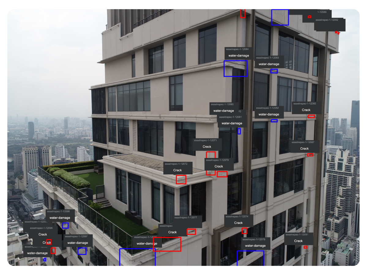
Detect surface damage and moisture issues before they become major repairs.
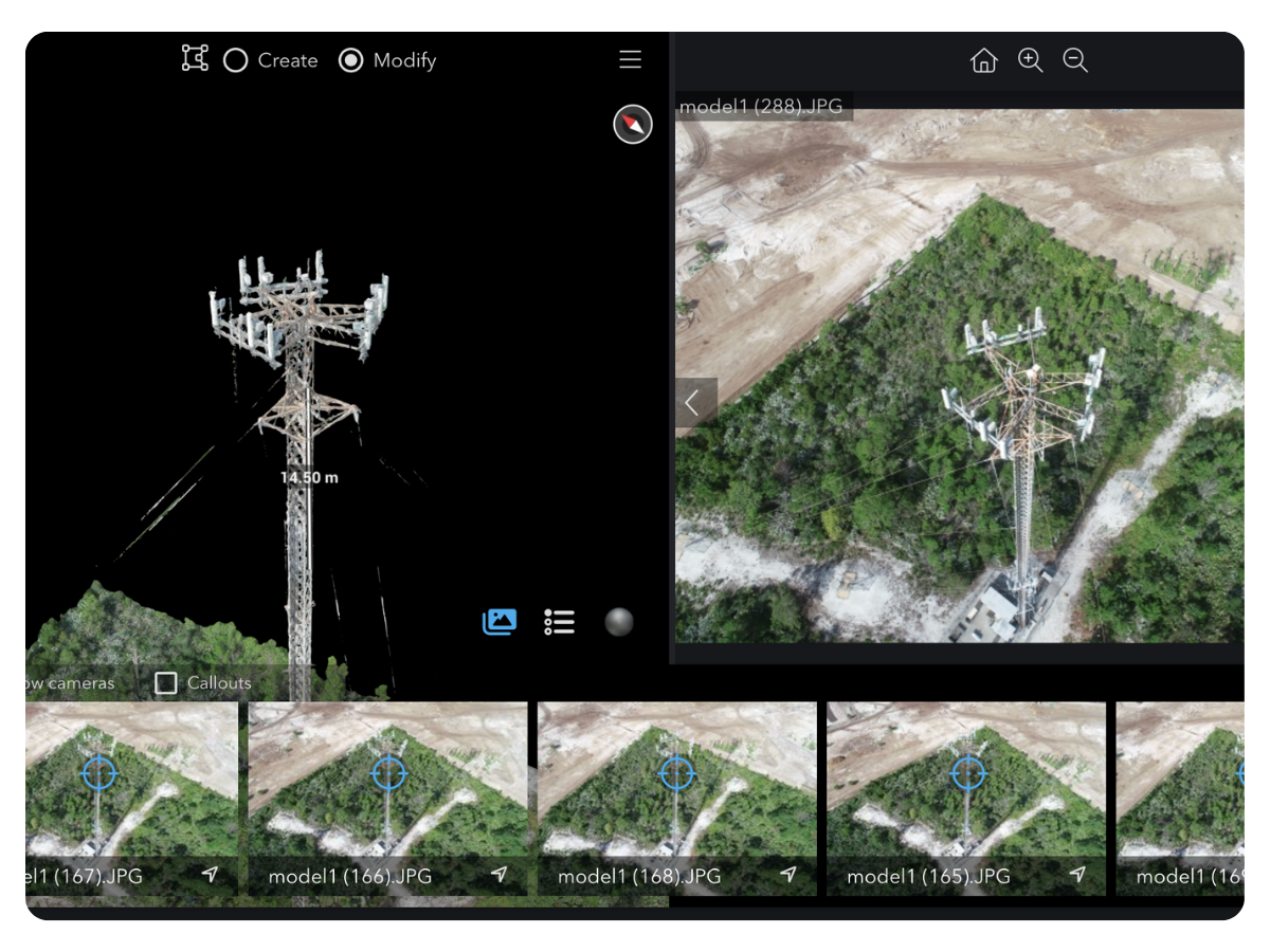
Prevent outages and failed installs with accurate, inspection-grade tower data.
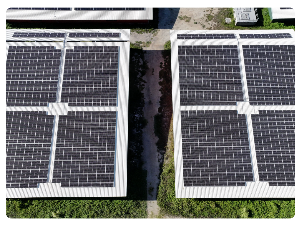
Design and permit solar systems that install right the first time.
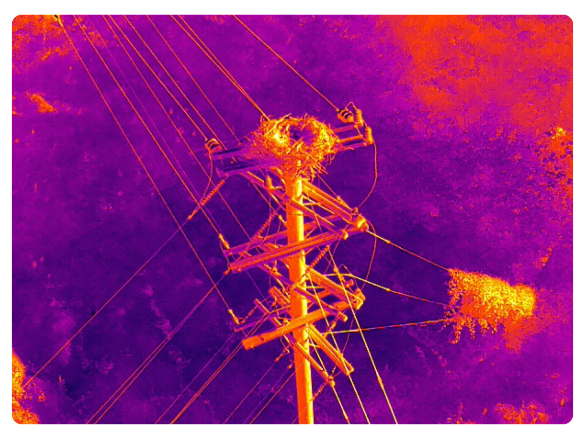
Find defects and clearance risks early to avoid outages and emergency repairs.