How Drones Help with Commercial Real Estate
Drones are used in the real estate process from planning, development, inspections, marketing, maintenance, and even rentals!
Rather than in-person visits, we're able to capture data from the sky and re-create your property in an accurate representation. If you want to learn how you can capture aerial photography for your commercial properties, check out this blog post >
Our services include:
- Aerial Photography (HDR, RAW, timelapse,
hyper-lapse, 24-hour turnaround)
- Aerial Videography (4K, music, branding, informational, fly-throughs)
- Offering Memorandums with traffic and investment details
- Inspections (roof, facade, large infrastructure, etc)
- 360 Virtual Tours (inside and out)
- Site Maps and ALTA surveys
- 2D Mapping & 3D Modeling
- As-Built Documentation
- Social Media marketing content (vertical and horizontal versions)
- Drone Pilot Training to build an in-house fleet
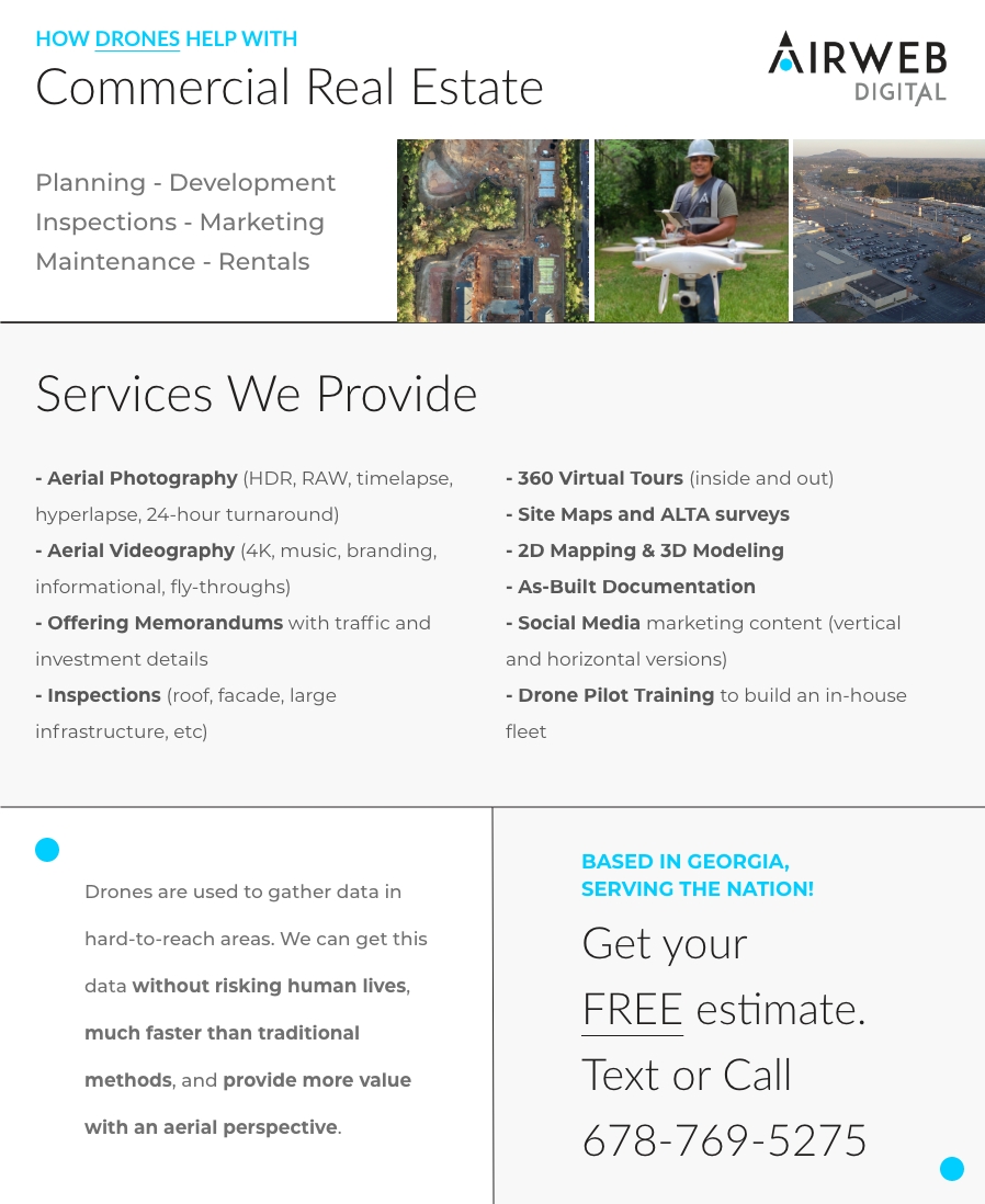
Drones are used to gather data in hard-to-reach areas. We can get this data without risking human lives, much faster than traditional methods, and provide more value with an aerial perspective.
DOWNLOAD FLYER >>WANT THE TEMPLATE?Thanks for your interest! Here's the template download and some helpful links: TEMPLATE DOWNLOAD >>
1) Want your work featured on our channels? Visit the Drone pilot success hub
2) Ready to skill up? View our Drone pilot training programs
3) Looking to train a fleet? Check out our Consulting packages for organizations
4) Have a project to refer us to? We provide 1-year residual commission pay
This is a small peek into our wheelhouse and we’re excited to see how we can grow together.
If you would like to to discuss partnership opportunities, please text/call at 678-769-5275 or email info@airwebdigital.com
Oops! Something went wrong while submitting the form.